Posted on 1 Comment

Escaping COVID Hard Times at Wyllys Falls

When times get tough, a return to nature is sure to lift your spirits. Nestled between busy I-384 and not quite as busy, Spring Street is a quiet little valley cut by Birch Mountain Brook. The Manchester Land Conservation Trust owns the land.

Wyllys Falls March 2021 270
Boulder on Spring St Across from Tam Rd.
Plaque on Boulder

A short hike down the embankment from the Spring Street boulder will take you to the brook.

Wyllys Falls March 2021 286
Path to Brook
*Wyllys Falls March 2021 001
Birch Mountain Brook

Upon reaching the brook, a right turn will take you to Wyllys Falls. However, the embankment on this side is too steep to walk along. You must find a way to cross the brook to get to the hiking trail on the other side.

*Wyllys Falls March 2021 004
Steep Embankment

If you feel nimble and brave, there are plenty of fallen trees you can balance on to get across the water.

*Wyllys Falls March 2021 002
Fallen Trees

If you have a dog on a leash, a camera, and backpack, and your sense of balance isn’t what it used to be, and your legs have been around for six decades or more, you might just take off your shoes and socks and wade through the brook to the other side. It isn’t too deep, but spoiler alert, it’s frigid.

*Wyllys Falls March 2021 003
Shallow Brook

Wyllys Falls is a short walk down the path. You will find a peaceful, joyful escape from hard times and be blissfully unaware of the highway nearby. Birds and moving water will be the only sounds! Aaaaahhhh!!!!

Wyllys Falls

‘Tis the song, the sigh of the weary.

Hard times, hard times, come again no more.

Many days you have lingered too long around my door.

Oh, hard times, come again no more.

Ohhhhh, hard times, come again no more.

Song by Stephen Foster, Sung by Joan Baez & Emmylou Harris
Posted on Leave a comment

Perambulating the Bounds with Esther

947B6EA4-1E48-4B45-86B8-55FC993B11EEOn Mother’s Day morning, with snow still coating some surfaces in Manchester, Esther and I took a walk on the White Trail at the Bush Hill Preserve. It was a cold, bright, crisp morning for a walk. The trails are well-marked and well cared for. I learned about something known as perambulating.

IMG_1253
Snow on the Roof

Yes, that is snow, and yes, it is May 10 in Connecticut.

img_1243
Esther Checking  the Bounds


7BC45E66-B266-479C-A5D5-1454EF98E47B
Explanation of Perambulating the Bounds

I have never heard this expression, and I was born well before 1979.

5B6F69EE-62F1-415D-ABDF-07BDB71773AF
Glastonbury Side of the Bounds

1AA77BA5-D528-4EB0-9107-2E4B3A5C0EDB
Some of the Botti Farm Neighbors

I am grateful to the volunteers at the Manchester Land Trust for all of the work put in to purchasing, preserving, and caring for open space.

Posted on 18 Comments

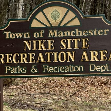
Nike Site Recreation Area & Trails

The Nike Site, off of Keeney St at the end of Garden Grove Rd., is a fascinating place to explore. From 1957-1961 the land was a U. S. Army anti-aircraft defense site. There were twelve of these Nike Sites in CT.  The installation in Manchester protected this area (Hartford? Pratt & Whitney?) from military planes that entered our airspace. The army used radar and missiles to detect incoming enemy planes and was considered a last line of defense to protect the U.S. during the Cold War. The military decommissioned the site in 1961 as advances in technology made the missiles obsolete. I don’t think the deployment of any missiles ever happened from the Manchester Nike Site (or any of the sites for that matter).

When the army returned the land at the Nike Site installation to the town of Manchester,  the recreation department found another purpose for the area. Today there is a pre-school, indoor shooting range, baseball field, the CT Concert Ballet, pickleball courts, hiking trails, and some buildings that look empty but (peeking in the windows) are obviously used for storage.

fullsizeoutput_30aa

DSC_0232
Baseball Field

DSC_0234
Pickleball Courts

The trails are not well marked at Nike.  The Recreation Department has this little booklet of town trails with maps, but the Nike Site did not make the final cut.  Here is the link to the town’s little hiking booklet:

http://recreation1.townofmanchester.org/NewRecreation/assets/File/Trail%20Guide_Update_S19.pdf

On the CTMQ website, I found this map of the trails (which I have altered slightly) . The CTMQ blog is one of my favorites, and when the CQ is over and you are looking for something to do in CT, you need to go to the website and check it out. You won’t be disappointed. Here is the link: http://www.ctmq.org

fullsizeoutput_30ab

Hiking on the Nike Site trails and abandoned roads is an opportunity to look back at the land-use history of this area since 1957. There is an abandoned, (serious) double yellow line road that connected what is now Hercules Dr. to Faith Circle. Army officers and their families lived on Faith Circle.

A radar tripod was at one time attached to the three metal plates of this cement pad.

IMG_1170
Old Radar Pad

There is a cairn where you take another trail out to Manchester Country Club.

IMG_1040

Other features at Nike include a well-built lean-to, cement pads, assorted buildings, metal objects, telephone poles, and water towers.

This slideshow requires JavaScript.

I found an abandoned ski slope and an abandoned baseball field, to be the most intriguing elements. Internet research reveals that the ski area was called Northview Ski Slope. It was open from 1969-1979. Vandalism, including cutting the ropes on the rope tow and driving a four-wheel vehicle into the rope tow building caused the town to shut it down.

DSC_0236
Pulley from the Old Rope Tow

Most of the poles from the rope tow are still standing with the pulleys attached.  Only this one has fallen over.

1FAD6B01-B012-43D9-9BD4-07A85A59AF86
Broken Rope Tow Pole

Trees and brush now cover most of the ski slope, making it hard to visualize people skiing on that hill.  But, there are a couple of clearings on the old trails where you can still picture people coming down on their skis.

One of the trails looks like it had a good view of Hartford.

Last but far from least, is the abandoned baseball field. The field is down in a valley closer to Hackmatack St.

46326BE4-AF00-4B5D-A7B9-CEBF029E45B6_4_5005_c

I couldn’t find any mention of the field on any sites related to the U.S. Army use of the Nike Site or the Manchester Recreation Department. I think the soldiers working at the installation used the field.  The only evidence of access to the grounds is a path from Faith Circle.  It doesn’t look like there was ever a road or parking area down there.

Was the field used only for pick-up games between those stationed in Manchester? Maybe teams from some of the other Nike Sites in the region came up to play.

Here are some pictures of the old backstop and old cedar posts that held the player’s benches.

IMG_1127
View of Weed-covered Backstop from Homeplate

IMG_1135
Behind the Backstop Looking Out at the Field Toward First Base

3051E693-5483-4B7F-9D09-D26F1C8C9FD1_1_201_a
Away Team’s Bench?


More photos of the area include home plate and the pitcher’s rubber.

IMG_1137IMG_1124IMG_1125IMG_1126

This trail off of Faith Circle takes you down to the field.

Every time I walk around the Nike Site, I discover something new.  I haven’t hiked the trail out to the golf course yet.   I am grateful for the creative people who have used this land and the buildings for recreation rather than just abandoning it like some of the other Nike Sites.

Posted on Leave a comment

Parks and Trails and Trails and Parks

DSC_0370This picture taken at Charter Oak Park offers contrasting views of the wildness of Hop Brook on one side of the trail and the green playing fields, courts, and playgrounds on the other. 

Basketball rims at Manchester parks were removed, and the playgrounds fenced off to protect the community from the spread of COVID-19. But many trails are wide enough to allow 6 feet of physical distance while providing an opportunity for social connection if walking with a friend.

I am grateful for the green spaces in Manchester. The latest upgrades to our parks and trails have re-connected us with the beauty and tranquility of nature. Substantial revisions and the guidance of friendly recreational staff members provide opportunities for exhilarating play and creative expression. It is a pleasure to anticipate the joyful return to the full use of our parks in the not too distant future.

In the meantime, social distance walking in one of Manchester’s parks or on trails, considering the words of Rachel Carson, is nourishment for the soul during these days of uncertainty.

“It is a wholesome and necessary thing for us to turn again to the earth and in the contemplation of her beauties to know the sense of wonder and humility.”

– Rachel Carson, A Sense of Wonder

Posted on 2 Comments

Cheney Rail Trail History Walk

In November, 50 people (including me) set off from the Fuss & O’Neill office building on Hartford Rd. to enjoy a talk about local history and experience the most recent addition to the Manchester parks on the newly completed southern portion of Cheney Rail Trail.

Screen Shot 2020-01-28 at 9.36.56 AM

Map courtesy of Manchester Land Trust: https://manchesterlandtrust.org/R.R.mapbrochure.pdf


The group hiked from Fuss & O’Neill on Hartford Rd. to the start of the new trail behind the Lofts at the Mills Apartments.  Then, on the trail, under the Park St bridge and up to Center St where we had to leave the trail briefly to cross Center St.  The new railroad trestle over Center St had not been completed at that time. The walk ended at Center Springs Park.  We returned along city streets.

Susan Barlow led the hike and provided information about the history of the Cheney Railroad and the surrounding area.  The talk came alive with stories of bygone days in Manchester and the use of pictures taken over 100 years ago of the areas we were standing in and walking through. 

The first site of historical significance is Old Engine Company Number One.  The firehouse located at the corner of Pine St and Hartford Rd was built by the Cheneys and donated to the town.  IMG_0872

Next stop on the tour was the Velvet Mill.  The Cheneys were interested in hiring skilled workers.  Some of the most skilled workers lived in Non-English speaking countries.  These workers arrived in Manchester from around the world to work at the Cheney Mills.  To overcome language issues, newly hired workers were given a card with a letter and a number on it similar to the V1 painted on the Velvet Mill in the picture.  This indicated the correct building and entrance to begin work.

DSC_0001
Velvet Mill Building

Across the street from the Velvet Mill is the Clocktower Mill.  The smokestack in the background is still in pretty good shape so it has been re-purposed as a cell phone tower.

DSC_0003
Clock Tower Mill with old smokestack in background
DSC_0085
Smokestack/Cell Phone Tower

Almost all of the old mill building are now apartments.  During the walk we stopped frequently while Susan explained interesting architectural features of the buildings, when they were built, and what was produced in each one.  

DSC_0012
Architectural Features Known as Medallions, Ashlar & Pilaster (Built in 1901)

In addition to the Velvet Mill and Clocktower Mill, there was a Spinning Mill, Ribbon Mills, machine shop, dye house, silk storage vaults and a storage building large enough for a railroad car.

DSC_0030
Old Silk Storage Vaults (still in use as storage)
DSC_0041
Railroad Car Storage

The Cheney Rail Service carried silk and passengers between the north and south ends of Manchester.  Large locomotives weren’t needed for these relatively light loads and a smaller engine called a Yard Goat was used.  Yard Goat?

The trail begins right near the old railroad yard. 


MHS3_SMRR_1932_Pict
Railroad Yard in 1932 and Cheney’s Yard Goat


DSC_0046
Railroad Yard Today

Some of the tracks were in good shape and were kept in place to create a sense of authenticity.

DSC_0050
Tracks left in place near rail trail.

One of the conductors lived in this house overlooking the rail yard right before the Park St. Bridge.

DSC_0092.jpg

DSC_0091
Cheney’s Goat is above the front door and on the shutters

The trail is 2.5 miles long and ends at Farr’s Department Store in the North End of Manchester.  The railroad was the shortest line in the United States but had the unique distinction of having more linear feet of tracks in the railroad yard than on the 2.5 mile route.

There are some great views from the bridge overlooking Center Springs Park.

IMG_0209.jpeg
Bridge overlooking Center Springs Park and turnaround point for the hike.
IMG_0186.jpeg
View of Center Springs Park from the Bridge

 The next free rail trail hike on the Cheney Rail Trail is scheduled for this Sunday at 1:00.  This hike will begin at the north end of the trail.  The meeting location is 2 Main St.  I highly recommend this activity!!!

Posted on 2 Comments

Charter Oak Greenway – Bolton to East Hartford


Manchester’s contribution to the East Coast Greenway is the Charter Oak Trail.  The East Coast Greenway “connects 15 states and 450 cities and towns for 3,000 miles from Maine to Florida. We are fostering a safe walking and biking route through the country’s most populated corridor.”

Many, many, many years ago a friend and I rode on ten speed bikes from West Palm Beach, Florida to West Hartford, CT. The East Coast Greenway did not exist in 1980 so we rode on back roads like Route 1 and 1A in Florida and Route 17 through Georgia and the Carolinas. We encountered a small problem in New Jersey and took quite a risk by riding our bikes on the Garden State Parkway from one exit to the next.

When the Greenway is complete a bike rider could ride from Florida to Maine almost entirely away from busy streets and traffic. Back in the day, I never would have dreamed this was possible. Given how polarized the country is today, the East Coast Greenway Alliance continues to be an amazing feat of interstate communication, cooperation and sharing of resources.

The East Coast Greenway is 33% complete but the section of the greenway located in Manchester is 100% complete. Enjoy the ride!!

Posted on Leave a comment

Multi-Use Trails Connect Manchester Neighborhoods (Part 2)

Update with August Pictures – What a difference a few months can make IMGP4897IMGP4879IMGP4925IMGP4875IMGP4914IMGP4916IMGP4891The rejuvenation of Center Springs Park has been a great addition to downtown Manchester. Trails through the park connect downtown Manchester to the Parkade.

 One Sunday morning in April, after a delicious breakfast at Sol de Borinquen Bakery Jr. we took a walk from the bakery up Main St in downtown Manchester through Center Springs Park to Broad St across from the parkade.

View of Main St from table at Sol de Borinquen Bakery Jr
View of Main St from a table at Sol de Borinquen Bakery Jr

IMG_0236
Entrance to Center Springs Park from Lincoln Center Parking Lot

IMG_0235.jpeg

The sights and sound encountered while walking on city streets is entertaining but it’s a pleasant change of pace to walk on the trails through the park. Thoughtful design in Manchester has created a unique connection between one commercial area and another.

IMG_0238
Center Springs Falls “Second-Best Fishing Place of the Podunks” – History of Manchester, Connecticut, by Mathias Spiess and Percy W. Bidwell, 1924

IMG_0242
Bigelow Brook

IMG_0233
Disc Golf

IMG_0229.jpeg

IMG_0230
Shady Area (when the leaves come out in a month or so)

IMG_0243
Fishing Pier on Pond with Cheney Rail Trail Bridge in the Background

IMG_0244.jpeg

IMG_0245
Looking Back at Center Springs Park

IMG_0248
Parking Lot on Broad St near Parkade

Posted on Leave a comment

Multi-Use Trails Connect Manchester Neighborhoods

The Charter Oak Greenway section of the East Coast Greenway provides travel through the south end of Manchester from Bolton to East Hartford by foot or bike. The trail is an exciting way to see Manchester as it winds it’s way along Highland St across and along Birch Mountain Brook and Hop Meadow Brook and through Charter Oak Park and finally the grounds of Manchester Community College and a huge array of solar panels..


Someday soon the Cheney Rail Trail will connect to the East Coast Greenway to travel north.  Construction will begin this year.


nsAKiRxdQTC+5uQ3cKjWww
Cheney Rail Trail Bridge

fullsizeoutput_2cb7
Beautiful Morning in Center Springs Park

fullsizeoutput_2cb6
View of the Fishing Pier and Center Congregational Church Steeple

+cMgkhi5TYCYvQsFkBhhQg
Foot Path to Center St.

Zz3BsYxzRmG1Blw0RpbyHA
Railroad Bridge over Center St.